
by Carl Pierer
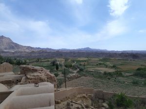
Yazd, one of the big three Tourist destinations in central Iran, has a rather challenging climate. With summer temperatures often exceeding 40C and hardly any precipitation at all (49 mm per year), water is a major concern. The city is rightfully famous for its wind towers (بادگیر) and qanats (قنات). While the former were and sometimes still are used for cooling houses, water reservoirs or storage rooms, the latter used to provide the city with water. Walking through the city, located in this rather inhospitable environment, one is constantly reminded that question of water dominates many aspects of life: from the garden and parks to agriculture and industry, from housing location to food storage and cooling. For many of these, the ingenious use of qanats provided an answer.

Writing in 1968, Paul English [2] states that in Iran alone 15 million acres (roughly 6 million hectares, or 60.000 km2) of cultivated land are watered by 37.500 qanats. This, at the time, corresponded to between one-third and a half of the total cultivated land. Historically, they provided up to ¾ of the water used in Iran. [1] Being such an important feature of Iranian cities, it is worth looking at some of their technical details.
Construction of a qanat starts with the finding of a suitable site. This is usually on the slope of a mountain, uphill from the village or agricultural fields. An initial well is dug to access the aquifer. This well is used to test whether the water supply provides enough water for the village by measuring the replacement rate of the water. If the water supply is found to be sufficient, the well is designated as the mother well, from which the qanat emanates. These mother wells vary in depth from ten to a few hundred meters. The crucial next step is the calculation of the qanat’s alignment. The slope has to be such that the water surfaces just before the fields to be irrigated. An early surfacing would mean that the water flows in the open, subject to evaporation and contamination. However, if the slope is too steep, the qanat will erode too quickly and crumble.
Qanats can cover long distances, the longer ones reaching from 30km to over 50km, so rather precise calculations for the slope are necessary. The construction then begins from the bottom end of the canal, the workers working their way backwards. Every 50 to 100 meters, the workers build a vertical shaft, both for ventilation and access. The tunnels themselves are dug to a width of around one meter and a height of roughly one and a half meters. Sometimes, these tunnels are stabilised by inserting clay hoops in the tunnel. The sheer work going into the construction and maintenance of qanats makes these very significant infrastructure investments. [2]
The presence of qanats had a significant influence on Iranian villages and cities. First of all, making water accessible in places where it is scarce, the development of qanats allowed settlements to locate in previously unsettled places. On the one hand, qanats allowed older cities, which were often located in river valleys, to expand and sustain a larger population, since it made more land available for agriculture through irrigation. On the other, and more importantly, it made the settlement of alluvial fans, where the ground water level was too low to be accessible by other means, possible. In particular, the Iranian plateau could now sustain permanent settlements. [4]
Secondly, the presence of qanats is visible in the very structure of a city. Some of these characteristics English describes in a rather poetic manner:
The built environments of most alluvial fan towns and villages on the Iranian Plateau are aligned along the major watercourses that run from the mouth of the qanat down slope through the length of the settlement. In larger and more complex basin settlements, smaller streams of water emanating from the points of division of several qanats form a spatial skeleton of parallel pathways lined by village structures, walled orchards, and gardens. They are trunk lines of human activity. [4]
The natural limitations of the qanat put quite strong constraints on the city’s morphology, which can best be observed in small villages supported by a single qanat. According to English, they have a triangular shape at the top of which are orchards and gardens and further downhill the distribution channels fan out to allow a larger area to be irrigated. At the lower end, a grid of rectangular plots is located, which is designed in such a way that enough water is delivered in the time it takes to flow through the plot. But the qanats also impose a certain structure in larger cities. In Yazd, for instance, major linear axes intersect at right angles, thus forming very large blocks, which are accessed through many shorter dead ends. This distinct geometry is traced back to the network of water channels which used to irrigate nearby orchards or fields. [4] [5]
As a side note, it would be interesting to compare this to contemporary urban planning, where a classical and influential paper by Peter Newman and Jeffrey Kenworthy establishes transport as a crucial factor shaping the city. There, they find three kinds of cities: walking, transit, and automobile. Presumably, the dominant mode of transport in traditional Iranian cities would be walking. Such a city, for Newman and Kenworthy, is characterised by mixed land-use, high population density and an organically grown structure. It is not clear that a city or village, where water procuration and distribution is the main concern, would be organised in the same way. However, to pursue this argument here would go beyond the scope of this article.

Lastly, the presence of qanats also means that the city’s social structure is expressed in a striking way. One remarkable feature is that there is a geographical stratification of households: wealthier families will locate on the hillside, further upstream of the qanats, thereby having access to cleaner and fresher water. Some very wealthy houses will be placed directly on a qanat, having a special room cooled by the small stream of water. Tall shafts would reach up from this room to connect it to a wind tower. During summer, the wind would blow against the tower, which is oriented in such a way that it forces the air down to circulate at the water level, thereby providing additional cooling. This room would be used for storing food, washing clothes, or simply as a comfortable spot to escape the summer heat. A little bit uphill from the village, usually water mills can be found, which were used to process the agricultural products. Closer to the top of the village, water is diverted for public use: a cistern, which provides clean and fresh water to all inhabitants, a public bath, and a mosque. While in larger cities this structure is more complex, “in most settlements, social patterns are directly related to water quantity and quality. Alterations in one system involve changes in the other.” [4]
*
It is clear then that, while qanats have had a remarkable success and spread to many parts of the world, on the Iranian plateau in particular qanats are strongly interwoven with a great many aspects of life in traditional villages. From the city shape to street geometry, from the location of households to individual houses’ architecture, the influence of qanats can be seen. It would then not be surprising to find that they also influence the social structure and organisation of village and city societies. More precisely, what socio-political dimension does the presence of qanats imply? This question will be discussed in the second part of this article.
***
References:
| [1] | D. R. Lightfoot, “The Origin and Diffusion of Qanats in Arabia: New Evidence from the northern and southern Peninsula,” The Geographical Journal, pp. 215-226, 2000. |
| [2] | P. W. English, “The Origin and Spread of Qanats in the Old World,” Proceedings of the American Philosophical Society, pp. 170-181, 1968. |
| [3] | D. R. Lightfoot, “Qanats in the Levant: Hydraulic Technology at the Periphery of Early Empires,” Technology and Culture, pp. 432-451, 1997. |
| [4] | P. W. English, “Qanats and Lifeworlds in Iranian Plateau Villages,” Yale F&ES Bulletin, pp. 187-205, 1998. |